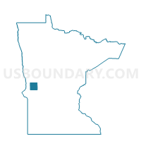
Ashby Voting District, Grant County, Minnesota
About
Outline

Summary
| Unique Area Identifier | 602051 |
| Name | Ashby Voting District |
| County | Grant County |
| State | Minnesota |
| Area (square miles) | 0.58 |
| Land Area (square miles) | 0.55 |
| Water Area (square miles) | 0.04 |
| % of Land Area | 93.56 |
| % of Water Area | 6.44 |
| Latitude of the Internal Point | 46.09310470 |
| Longtitude of the Internal Point | -95.81565130 |
Maps


Graphs
Select a template below for downloading or customizing gragh for Ashby Voting District, Grant County, Minnesota